

Belle Park from the Air
1924-2024
A video by Dorit Naaman, Francine Berish, Laura Murray and Matt Rogalsky, 2024
From 1924 until the present, Belle Park and Belle Island have been photographed regularly from the air — part of a worldwide practice of geographical documentation for military, climatological, and economic purposes. Belle Park from the Air shows the changes and continuities of this particular space over a century as the wetland was made into a dump and then a park. Initially, we had mainly informational aims (some of you pored over these images with us!), but we find that what we have created, especially with the soundtrack, has a bit of magic to it, and invites response and discussion well beyond the facts. We hope you think so too.
Read a blog post by Francine Berish
An Interview with Laura Murray and Dorit Naaman on Your Local TV
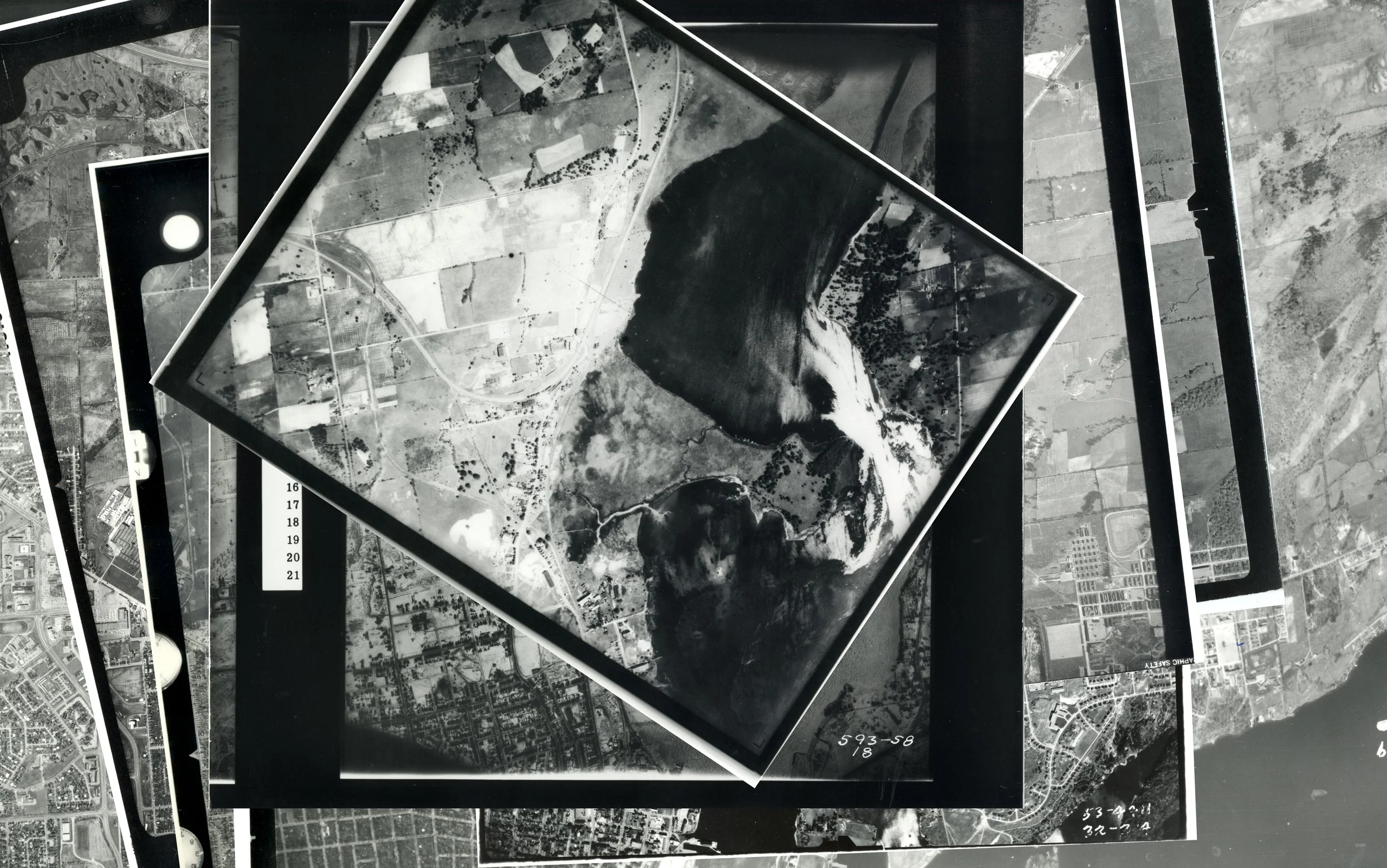
Where do these photos come from?
The NAPL and Ontario Provincial photos listed below (along with many others) can be visited at Queen’s University Stauffer Library in-person. Some of them have been digitized and are available here. The aerial imagery for 2007-8, 2014, and 2019 was sourced from the Scholars Geoportal and is also available through the Ontario GeoHub, the open data distribution page for Land Information Ontario (LIO).
Have questions about accessing aerials, maps or geospatial data? Don't hesitate to get in touch with Queen’s Library. There are many different ways to reach us!
National Air Photo Library (NAPL)
Year Flight Line Photo Numbers
1924 HA 22 26, 33, 34, 35
1937 A5406 33, 34
1945 A8882 37, 38, 39
1948 A11466 16, 17, 18, 19
1954 A13968 44, 69, 70
1955 A14613 25, 26
1959 A16531 41, 42, 43
1962 A17923 1 26, 127, 128
1965 VRR 2638 408 619, 649, 1609, 1610
1966 C3399/66 9095A3 69, 70, 71
1974 A23663 200, 201
1975 A24280 14, 15
1977 A24648 54, 55
1977 A37553 29, 30
1981 A25646 34, 35
1985 A26648 160, 161, 169, 170
1990 AF65190 105, 106, 107, 108
Ontario Provincial
Year Flight Line Photo Numbers
1941 593 (18) 58, 59
1953 53-4411 213, 214, 215
1978 78-4417 385, 386
Sound sources (all collected, composed and mixed by Matt Rogalsky):
underwater photosynthesis (the rapid ticking and fizzing sounds)
nearby highway traffic and light planes overhead
seasonal rivulets
plucked strings woven from cattail fibers
redwinged blackbirds and other marsh birds